The Edge the Town Was Built For
Brighton is a town that turned round to face the water. The old fishing settlement of Brighthelmstone had its back to the sea in every sense that mattered: the sea was work, weather and danger, and the town huddled above it. From the middle of the eighteenth century that reversed. Sea water was prescribed as a cure, sea air as a tonic, and sea views as a pleasure, and within a few decades Brighton had rebuilt itself along the shoreline in terraces and squares that exist to be looked at from the beach and to look out from. The seafront is not a decorative addition to Brighton. It is the reason the modern town has the shape it has, and the Royal Pavilion is a short walk inland from it precisely because the Prince Regent came here for the same reasons everyone else did.
Before the Piers: The Chain Pier
The first structure of consequence on this beach was the Chain Pier, opened in the 1820s. It was not a pleasure pier in the later sense but a landing stage, a suspension structure on chains designed to let passengers board vessels for the cross-Channel crossing without the indignity of being carried through the surf. It quickly acquired a promenade function as well, because people will always pay to walk out over water.
It was destroyed in a storm at the end of the nineteenth century. Nothing survives to walk on, but it established the idea that everything since has developed: a pier as a place to go, not merely a place to embark from.
The Palace Pier
Brighton Palace Pier opened at the very end of the nineteenth century and remains the working pleasure pier of the town. It is a late example of the type, built when pier engineering was mature and when the business model had settled: get people out over the water, then sell them amusement while they are there.
What is worth noticing is how honestly it does that. The seaward end carries fairground rides, the deck carries arcades and kiosks, and the structure beneath is exposed ironwork visible from the beach. It is loud, bright and unapologetically commercial, and has been since it opened; visitors expecting Victorian restraint are misreading the building type. Entry to the deck is generally free while rides are paid for separately, and the wind at the far end is reliably colder than the shore suggests.
The West Pier and Its Long Ending
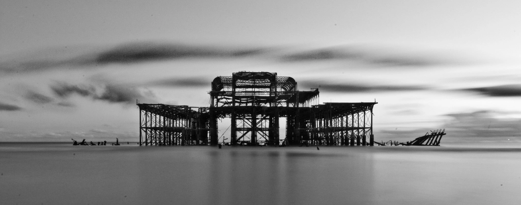
A short distance west stands the other pier, or what is left of it. The West Pier opened in the 1860s to a design by Eugenius Birch, the most accomplished pier engineer of the period, and it was widely regarded as the finest example of the type in Britain. It closed to the public in the 1970s, decayed through decades of failed rescue schemes, partially collapsed, and was then gutted by fire in 2003.
What remains is a blackened skeleton standing offshore, slowly reducing. It has become, unexpectedly, one of the most photographed objects in southern England, and in winter it is the roosting point for large flocks of starlings whose evening murmurations draw crowds along the promenade. There is something instructive in the contrast: two piers within sight of one another, one still selling candy floss, the other a ruin that has become a monument. Between them stands the observation tower built on the West Pier’s landward site, which uses the memory of the pier as much as the ground.
Two Levels of Promenade
The upper and lower walks
The Brighton seafront is unusual in having two continuous walking levels. The upper level runs along King’s Road at the top of the sea wall, giving the long view of the Channel and the fronts of the Regency terraces behind. The lower level runs at beach height, beneath the road, in front of a long series of brick and flint arches built into the sea wall.
The arches themselves were originally practical: storage for boats, tackle and equipment, and structural mass to hold the wall against the sea. They now house cafes, bars, galleries, workshops, fishing displays and small businesses, and the lower promenade in summer is effectively a second high street. Ramps and steps connect the two levels at intervals, which is worth knowing if you have a pushchair or limited mobility, since the connections are not continuous and the gaps between them can be long.
Madeira Drive and the terrace
East of the Palace Pier the seafront changes character again. Madeira Drive runs at the lower level beneath a long Victorian cast-iron terrace and lift structure built into the cliff face. It is a remarkable piece of ironwork, and for years much of it has been in poor condition, fenced off and subject to long-running restoration efforts. Check locally before planning a walk along it, as sections open and close as work proceeds.
Why Brighton Has Shingle
Flint, chalk and drift
Visitors regularly ask where the sand is. The answer is geological. This coast is chalk, and chalk contains bands of flint. As the cliffs and seabed erode, the soft chalk dissolves and disperses while the hard flint nodules survive, are rolled and rounded by wave action, and accumulate as shingle. The beach is, in effect, the insoluble residue of the coastline.
Longshore drift then moves that shingle along the shore, generally eastwards on this stretch, which is why the beach is divided by timber and rock groynes. Each groyne interrupts the drift and holds a wedge of shingle in place; without them the beach would migrate and the sea wall would be exposed. If you look along the coast you can often see the difference in beach level on either side of a groyne, which is the drift made visible.
At low tide, particularly on a big spring tide, sand and clay flats are exposed below the shingle bank, along with rock pools and the stumps of old timber structures. So Brighton does have sand; it has it for a couple of hours, twice a day, at the bottom of the tide.
Swimming, Tides and Common Sense
People swim at Brighton all year round, and the town has an active cold-water swimming culture. It is not, however, a gentle paddling beach, and a few characteristics deserve respect.
- The beach shelves steeply. Shingle beaches drop away quickly close to shore. You can go from ankle-deep to out of your depth in a couple of steps, which catches out both children and confident adults.
- Groynes generate currents. Water moving along the shore is deflected by the groynes, and the flow close to them can be strong. Swimming out from the middle of a bay between groynes is safer than swimming alongside one.
- Lifeguard cover is seasonal and zoned. Patrolled areas and staffed months change from year to year. Look for the current signage on the day and swim within the marked zone rather than assuming cover exists.
- The shingle is hard on feet. Wet pebbles are slippery and dry pebbles are sharp. Swimming shoes turn an awkward entry into an easy one.
- Check the tide before committing. Tide times shift daily. Walking east or west at the base of the cliffs is only safe with the tide in mind, and rising water can cut off a stretch of lower beach faster than expected.
How the Seafront Made the Modern Town
The consequences of all this are visible everywhere behind the beach. Because the sea became the attraction, the most valuable land became the land with a view of it, and Brighton and neighbouring Hove filled with terraces, crescents and squares deliberately composed to face the water — open-ended squares that frame the sea rather than enclosing a private garden. That is a different urban idea from Bath or Bloomsbury, and it comes directly from the commercial logic of the resort.
The sea wall, the two-level promenade and the arches then created a public edge anyone could use, which is why the seafront has never been the private preserve of the terraces behind it. The Royal Pavilion is this story’s most extravagant expression: a royal residence a few hundred yards from a working fishing beach, in a town that had reinvented itself around the value of salt water.